
EchoLogger ECT 400S Single-Frequency Echo Sounder for DJI Matrice

EchoLogger ECT 400S Single-Frequency Echo Sounder for DJI Matrice

IS-EL-ECT-400S

Manufacturer doesn't allow for price to be posted. Please request a quote:

High-Resolution Shallow Water Bathymetry. 450 kHz. Drone-Ready.

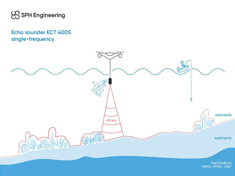
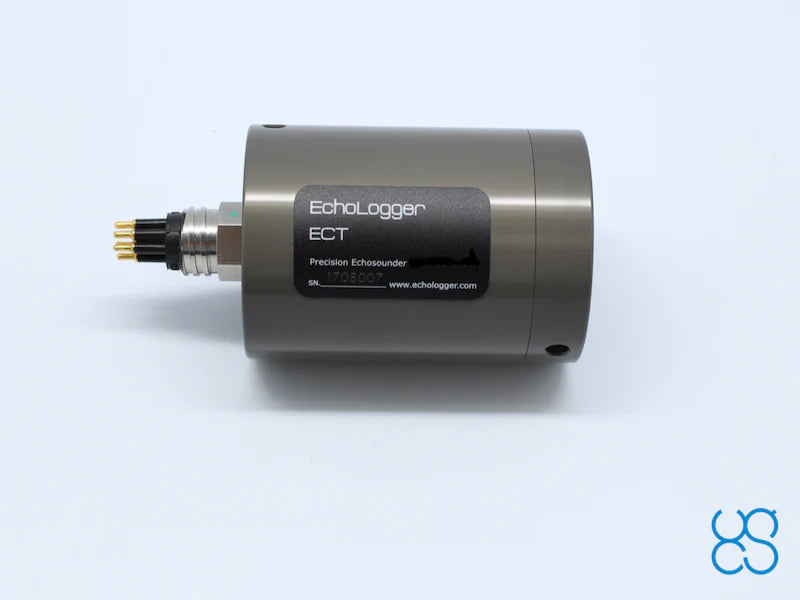
The EchoLogger ECT 400S is a professional-grade single-frequency echo sounder engineered for UAV-based hydrographic surveying in shallow water environments. Operating at 450 kHz with a tight 5° beam angle, the ECT 400S delivers high-resolution bottom detection from as shallow as 0.15 meters down to 100 meters — making it the precision choice for ultra-shallow surveys where low-frequency sensors are rendered ineffective by dead zone limitations.

Purpose-built for integration with the SkyHub onboard computer via RS232, the ECT 400S transforms DJI M350 RTK, M300 RTK, and M600 Pro platforms into capable, georeferenced bathymetric survey systems for shallow ponds, rivers, reservoirs, and coastal zones.

450 kHz. 5° Narrow Beam. 0.15m Minimum Range.
The ECT 400S operates at 450 kHz with a 5° conical beam — delivering exceptional bottom resolution and minimal off-axis interference in shallow water environments. With a minimum measurement range of just 0.15 meters, the ECT 400S covers ultra-shallow areas inaccessible to lower-frequency sensors limited by dead zone constraints. Built-in tilt and temperature sensors ensure data accuracy throughout dynamic UAV survey operations, while RS232 SkyHub integration enables seamless georeferenced data acquisition.

5° Narrow Beam — High-Resolution Bottom Detection

The ECT 400S's 5° conical beam at 450 kHz delivers exceptional bottom resolution in shallow water conditions. The narrow beam minimizes off-axis returns and side-lobe interference, producing clean, high-fidelity depth data in complex shallow environments — including ponds, rivers, reservoirs, and coastal zones where precision and data quality are critical.

Integrated Tilt & Temperature Sensors

Built-in tilt and temperature sensors ensure measurement accuracy and data quality throughout the survey flight. Tilt compensation accounts for aircraft attitude variations during dynamic UAV operations, while temperature data supports sound velocity correction for precise depth calculations in varying water conditions — delivering hydrographic-grade data quality from an aerial platform.

SkyHub RS232 Integration

The ECT 400S connects directly to the SkyHub onboard computer via RS232 interface and connector, enabling seamless data acquisition, GNSS timestamping, and integration with positioning data for fully georeferenced bathymetric datasets. Compatible with DJI M350 RTK, M300 RTK, and M600 Pro platforms via SkyHub integration.

Learn More +

High-Resolution Shallow Water Bathymetry. 450 kHz. Drone-Ready.

The EchoLogger ECT 400S is a professional-grade single-frequency echo sounder engineered for UAV-based hydrographic surveying in shallow water environments. Operating at 450 kHz with a tight 5° beam angle, the ECT 400S delivers high-resolution bottom detection from as shallow as 0.15 meters down to 100 meters — making it the precision choice for ultra-shallow surveys where low-frequency sensors are rendered ineffective by dead zone limitations. Purpose-built for SkyHub RS232 integration, the ECT 400S transforms DJI Matrice platforms into capable, georeferenced bathymetric survey systems.

450 kHz — 5° Narrow Beam for High-Resolution Detection

The ECT 400S's 450 kHz single-frequency operation with a 5° conical beam delivers exceptional bottom resolution in shallow water conditions. The narrow beam minimizes off-axis returns and side-lobe interference, producing clean, high-fidelity depth data in complex shallow environments including ponds, rivers, reservoirs, and coastal zones where precision matters most.

0.15m Minimum Range — Ultra-Shallow Coverage

With a minimum measurement range of just 0.15 meters, the ECT 400S covers ultra-shallow areas that are inaccessible to lower-frequency sensors limited by their dead zone. From near-surface to 100 meters depth, the ECT 400S provides complete bathymetric coverage across the full shallow-water survey envelope.

Integrated Tilt & Temperature Sensors

Built-in tilt and temperature sensors ensure measurement accuracy and data quality throughout the survey flight. Tilt compensation accounts for aircraft attitude variations during dynamic UAV operations, while temperature data supports sound velocity correction for precise depth calculations in varying water conditions.

Technical Specifications

  • Sensor: EchoLogger ECT 400S | Type: Single-frequency
  • Acoustic frequency: 450 kHz
  • Measurement range: 0.15–100m
  • Beam width (-3dB conical): 5°
  • Echo sounder weight: 275g | Total system weight: 2.4kg
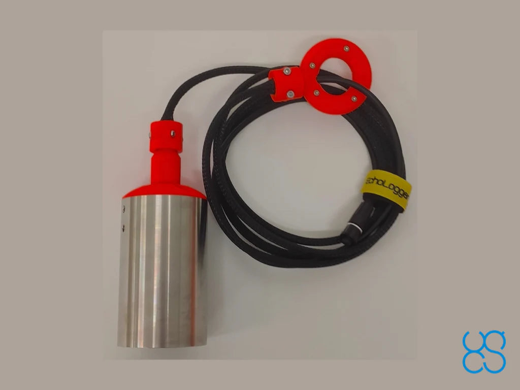
  • Interface: RS232 with SkyHub connector | Cable length: 2.5m
  • Compatible drones: DJI M350 RTK, M300 RTK, M600 Pro
  • HS Code: 90158040 (hydrographic instruments)

Please note: Additional components and software must be purchased to use this sensor with drones. A full set of required items will be proposed when you request a quote.


Recently viewed

