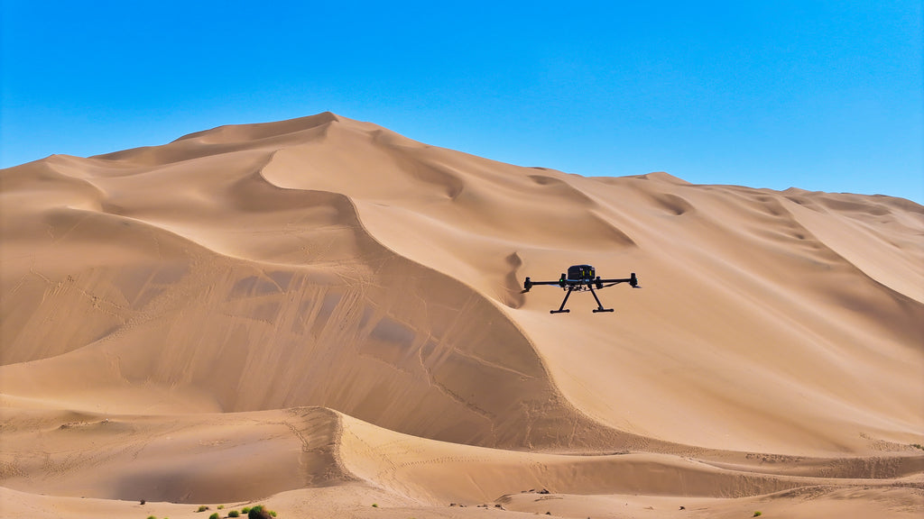
CHCNAV X500 Professional Multirotor Drone — Built for Demanding Aerial Missions
The CHCNAV X500 is a robust, carbon-fiber quadcopter engineered for professional aerial operations. With 58 minutes of flight time, a 5 kg payload capacity, centimeter-level RTK positioning, and a 20 km HD video link, the X500 is built to perform where it matters most — in the field, on real missions, in real conditions.
Whether you’re mapping terrain with LiDAR, capturing photogrammetry data with a high-resolution camera, or flying BVLOS missions with SmartGo software, the X500 adapts to your workflow. Choose the bundle that fits your mission — from drone-only to fully integrated LiDAR and photogrammetry systems.
Available Configurations
-
X500 (Drone Only) — The airframe, controller. Bring your own payload.
-
X500 Ready to Fly Combo (No Payload) — Complete flight system ready for your sensor of choice.
-
UAV LiDAR Mapping Bundle 1: Standard — X500 paired with a professional LiDAR sensor for aerial mapping and terrain modeling. Includes AA6 LiDAR, CoPre (Perm),
-
UAV LiDAR Mapping Bundle 2: Professional — Enhanced LiDAR configuration for higher-density point clouds and demanding survey environments.
-
UAV Photogrammetry Bundle (C504 Camera) — X500 with the CHCNAV C504 camera for high-resolution aerial photogrammetry and orthomosaic production.
Key Features
-
58-Minute Flight Time — Up to 58 min unloaded; ~52 min with 2 kg payload; ~40 min with 4 kg payload
-
5 kg Payload Capacity — Supports LiDAR, cameras, and third-party sensors via open SDK
-
Dual GNSS + RTK Precision — GPS, GLONASS, BeiDou, Galileo with centimeter-level hover accuracy (±0.1 m RTK)
-
Millimeter-Wave Radar Obstacle Avoidance — Detects obstacles up to 80 m for safe autonomous flight
-
vSLAM Precision Landing — Under 10 cm landing deviation for repeatable, accurate returns
-
IP55 Weather Resistance — Operates in winds up to 12 m/s and temperatures from −20°C to +50°C
-
20 km HD Video Link — 10.1″ 1920×1200 touchscreen controller with ~1,000 nits brightness and 5-hour battery life
-
SmartGo Mission Software — Full mission planning including BVLOS, waypoint automation, and real-time telemetry
-
Hot-Swappable B10 Batteries — 47V / 10Ah with self-heating below 11°C for cold-weather operations
Technical Specifications
-
Folded: 485 × 410 × 450 mm | Deployed: 770 × 804 × 450 mm
-
Empty Weight: ~4.4 kg (no batteries) | ~8.9 kg with batteries
-
Max Takeoff Weight: 13.9 kg
-
Max Speed: 23 m/s | Ascent: 8 m/s | Descent: 6 m/s
-
Wind Resistance: Up to 12 m/s
-
Operating Temperature: −20°C to +50°C
Ideal Use Cases
- LiDAR aerial mapping and terrain modeling
- Photogrammetry and orthomosaic production
- Infrastructure and utility inspection
- Urban planning and construction monitoring
- Disaster relief and emergency response
- BVLOS and autonomous long-range missions
The CHCNAV X500 combines enterprise-grade endurance, precision navigation, and payload flexibility in a platform built for professionals who can’t afford downtime. Configure it for your mission and fly with confidence.



 Ir directamente al contenido