CHCNAV Apache 4 Pro USV

CHCNAV Apache 4 Pro USV

8004010058

Manufacturer doesn't allow for price to be posted. Please request a quote:

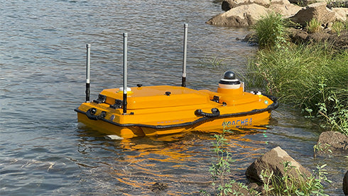
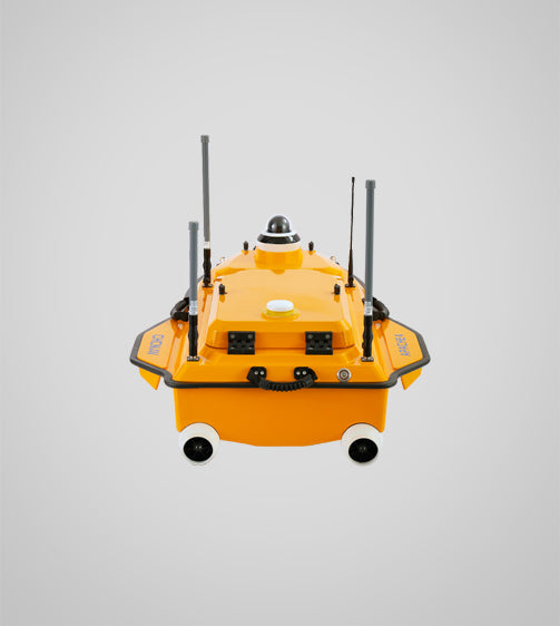
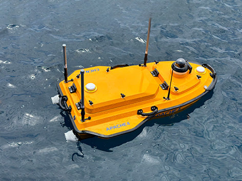
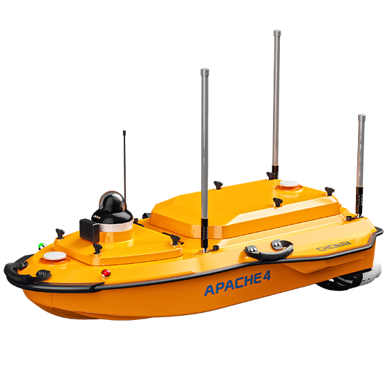
The CHCNAV Apache 4 Pro USV is a next-generation unmanned surface vessel built for high-precision hydrographic and bathymetric survey missions. Engineered for deployment in shallow, narrow, and hard-to-reach waterways, it integrates multi-beam echo sounder (MBES) compatibility, RTK/GNSS/IMU positioning, and anti-collision LiDAR into a rugged, compact catamaran platform.

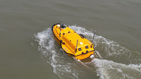
Jet pump propulsion eliminates debris risk in cluttered environments, while autonomous route planning enables hands-free mission execution. Lightweight enough for one-person deployment, the Apache 4 brings centimeter-level accuracy to rivers, reservoirs, coastal zones, and beyond — no crewed vessel required.

Highlights:
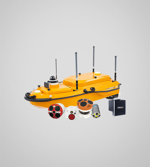
• Fully Autonomous Catamaran Design — Dual-hull stability optimized for shallow, narrow, and turbulent waterways. • Multi-Beam Echo Sounder Compatible — Preconfigured for MBES, GNSS/INS, LiDAR, SSS, ADCP, and SVS payloads. • RTK + GNSS + IMU Precision — Centimeter-level positioning with CHCNAV or third-party RTK systems. • Anti-Collision LiDAR Navigation — Intelligent obstacle avoidance and autonomous route execution for hands-free ops. • Jet Pump Propulsion — Zero exposed propeller risk; purpose-built for debris-heavy and shallow-water environments. • One-Person Deployment — Fits in an SUV, launches in minutes, operates without a crewed support vessel.

Feature

Spec

Dimensions

1.4 × 0.85 × 0.4 m

Weight

Approx. 17.5 kg (without payload)

Payload Capacity

Up to 15 kg

Propulsion

Jet pump system

Max Speed

5 m/s

Battery Endurance

Up to 6 hours (payload dependent)

Control Range

Up to 5 km (clear LOS with base station)

Navigation

GNSS + IMU + LiDAR obstacle avoidance

Sensor Compatibility

MBES, SSS, ADCP, SVS, GNSS/INS

Use Cases:

  • Bathymetric and hydrographic surveys
  • Reservoir, lake, and river mapping
  • Riverbed and seabed inspection
  • Sediment transport and erosion monitoring
  • Dam, bridge, and infrastructure safety studies
  • Environmental and pollution assessment
  • Coastal zone and port surveys

CHCNAV is a global leader in geospatial innovation, delivering field-proven GNSS, LiDAR, and unmanned systems to professionals worldwide. The Apache 4 Pro USV exemplifies their commitment to precision, portability, and mission reliability — engineered to perform where conventional survey methods fall short. Backed by CHCNAV's global support network and deep integration with professional hydrographic software, it's a complete solution for modern waterborne mapping.

Learn More +

CHCNAV Apache 4 Pro USV — Autonomous Hydrographic Survey Vessel for Professional Waterborne Mapping

The CHCNAV Apache 4 Pro USV is a professional-grade unmanned surface vessel engineered for high-precision hydrographic and bathymetric survey operations. Built on a rugged catamaran platform, it integrates multi-beam echo sounder (MBES) compatibility, centimeter-level RTK/GNSS/IMU positioning, and anti-collision LiDAR into a compact, one-person deployable system. Jet pump propulsion eliminates debris risk in shallow or cluttered waterways, while autonomous route planning enables hands-free mission execution across rivers, reservoirs, coastal zones, and beyond.

Key Features

  • Fully autonomous catamaran design with dual-hull stability for shallow, narrow, and turbulent waterways
  • Multi-beam echo sounder (MBES) compatible — supports MBES, SSS, ADCP, SVS, and GNSS/INS payloads
  • RTK + GNSS + IMU positioning for centimeter-level accuracy with CHCNAV or third-party RTK systems
  • Anti-collision LiDAR with intelligent obstacle avoidance and autonomous route execution
  • Jet pump propulsion — zero exposed propeller risk, purpose-built for debris-heavy and shallow-water environments
  • One-person deployment — lightweight, fits in an SUV, launches in minutes without a crewed support vessel
  • Up to 6-hour battery endurance and 5 km control range (clear LOS with base station)

Technical Specifications

  • Dimensions: 1.4 × 0.85 × 0.4 m
  • Weight: Approx. 17.5 kg (without payload)
  • Payload Capacity: Up to 15 kg
  • Propulsion: Jet pump system
  • Max Speed: 5 m/s
  • Battery Endurance: Up to 6 hours (payload dependent)
  • Control Range: Up to 5 km (clear LOS with base station)
  • Navigation: GNSS + IMU + LiDAR obstacle avoidance
  • Sensor Compatibility: MBES, SSS, ADCP, SVS, GNSS/INS

Ideal Use Cases

  • Bathymetric and hydrographic surveys
  • Reservoir, lake, and river mapping
  • Riverbed and seabed inspection
  • Sediment transport and erosion monitoring
  • Dam, bridge, and infrastructure safety studies
  • Environmental and pollution assessment
  • Coastal zone and port surveys

What's Included

  • APACHE4 Pro USV hull with D270 camera
  • 4× LiPo batteries (23100mAh 32.4V)
  • 2× battery chargers
  • Hard case
  • EC10 remote controller with accessories
  • RC/WiFi and 4G antennas
  • High-frequency radio antenna
  • ESC debugger
  • ADCP foam inserts (RP & RS-600)
  • Lean tube holder, USV screws, standard accessory package
  • Stainless steel thumb screws M6×14
Recently viewed