
Radar Systems Zond Aero 500 NG GPR System | Airborne & Ground Survey

Radar Systems Zond Aero 500 NG GPR System | Airborne & Ground Survey

IS-RS-ZOND-AERO-500

Manufacturer doesn't allow for price to be posted. Please request a quote:

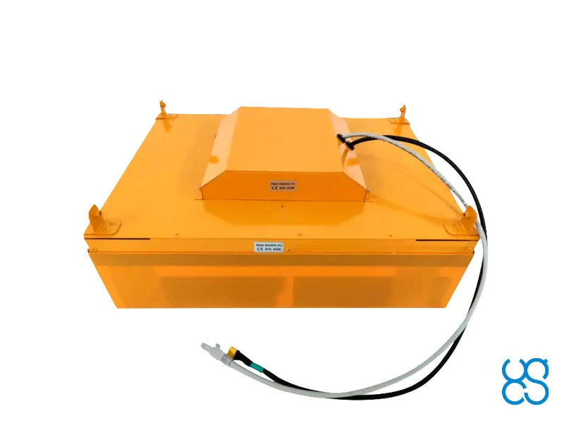
The Radar Systems Zond Aero 500 NG is a universal 500 MHz ground penetrating radar system for terrestrial and airborne surveys. Featuring real-time sampling (RTS) technology and advanced built-in digital signal processing, it delivers high-quality subsurface data with an exceptional signal-to-noise ratio in three deployment modes: drone-mounted, cart-mounted, or tow-rope dragged. At 2.1kg in airborne configuration with up to 4 meters of depth penetration, it is one of the lightest GPR systems available for medium-sized drones including the DJI M350 RTK and M300 RTK. Includes Prism 2 software and full kit. Contact Maverick for drone integration quote.

500 MHz. 4m Depth. 2.1kg Airborne. Three Deployment Modes. One GPR System.
The Zond Aero 500 NG is built around a single principle: maximum versatility without sacrificing data quality. Real-time sampling (RTS) technology and advanced built-in digital signal processing deliver high signal-to-noise ratio subsurface data across all three deployment modes — drone-mounted for large open area airborne surveys, cart-mounted for streets and confined spaces, and tow-rope dragged for surfaces unsuitable for wheeled carts. At 2.1kg in airborne configuration, it is one of the lightest 500 MHz GPR systems available for medium-sized UAV platforms. Up to 4 meters of depth penetration in average normal soil, up to 2,500 scans per second, and SEGY data format with trace geotagging make it a complete professional subsurface survey tool for airborne and terrestrial operations.

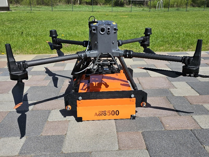
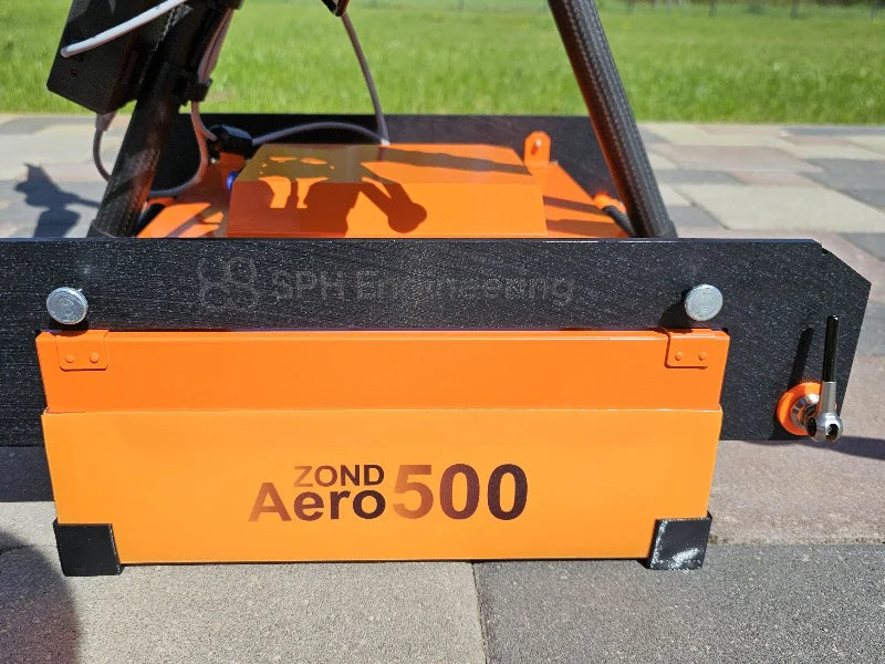
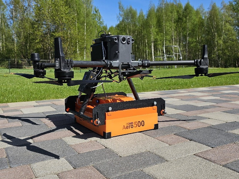
Airborne GPR. 2.1kg. DJI M300/M350 RTK Ready. At 2.1kg in airborne configuration, the Zond Aero 500 NG is one of the lightest professional GPR systems available for medium-sized UAV platforms. Powered directly from the drone's main battery via the standard payload power socket, it mounts to the DJI M350 RTK and M300 RTK with the included mounting kit — with mounts for other drone types available upon request.

500 MHz / 4m Depth. RTS Technology. SEGY with Geotagging. The 500 MHz center frequency with 200–900 MHz operating bandwidth delivers up to 4 meters of depth penetration in average normal soil. Real-time sampling technology and advanced DSP produce high signal-to-noise ratio data at up to 2,500 scans per second, output as 32-bit digital raw data in standard geophysical SEGY format with full trace geotagging for precise spatial referencing.

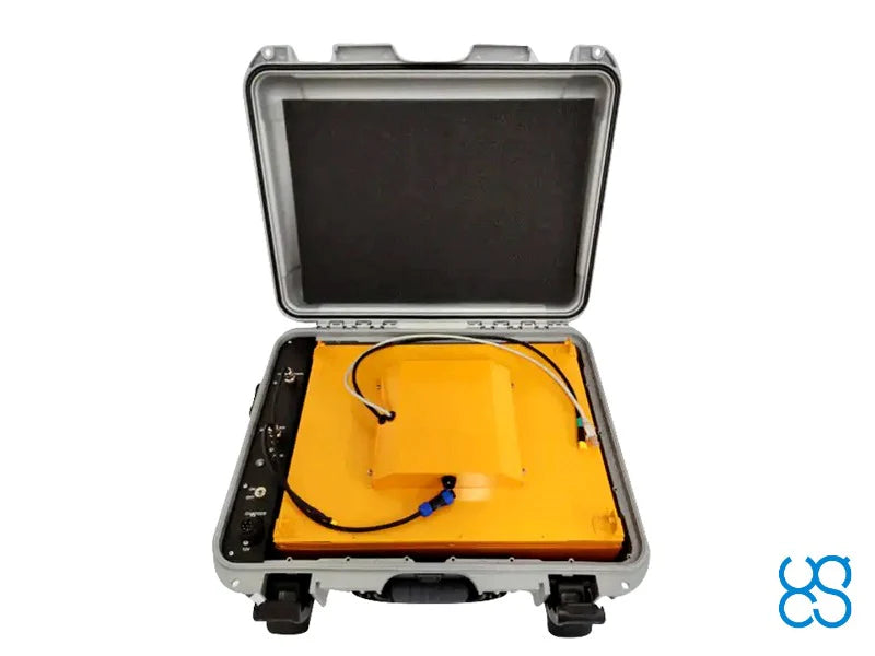
Complete Kit. Prism 2 Software. 12-Hour Ground Battery. The kit includes the Zond Aero 500 NG GPR system, Prism 2 data acquisition and processing software, NANUK protective case, 99 W/h Li-Ion battery with up to 12 hours of ground survey runtime, integrated Wi-Fi router, charger, tow rope, and DJI M300/M350 RTK mounting kit. IP68 protection in the case for ground surveys, IP52 in airborne configuration. -20°C to 60°C operating temperature.

Learn More +

500 MHz GPR. Airborne, Cart & Tow. 2.1kg. DJI M300/M350 RTK Ready.

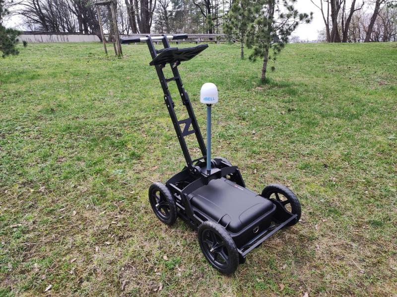
The Radar Systems Zond Aero 500 NG is a universal ground penetrating radar system engineered for both terrestrial and airborne surveys. Featuring real-time sampling (RTS) technology and advanced built-in digital signal processing, it delivers high-quality subsurface data with an exceptional signal-to-noise ratio across three deployment modes: drone-mounted for large open areas, cart-mounted for streets and confined spaces, or tow-rope dragged for surfaces unsuitable for wheeled carts. At 2.1kg in airborne configuration, it is one of the lightest GPR systems available for medium-sized drones including the DJI M350 RTK and M300 RTK.

Note: Additional components and software must be ordered to use this GPR with drones. A complete set is recommended — contact Maverick for a quote.

Key Specifications

Type Single-channel with shielded antenna
Center Frequency 500 MHz
Operating Bandwidth 200–900 MHz (-12 dB)
Depth Up to 4 meters in average normal soil (100ns time range)
Scan Rate Up to 2,500 scans/second
Sample Rate Up to 1,280,000 samples/second
Sample Output 32-bit digital raw data
Data Format Standard Geophysical SEGY (.sgy) with trace geotagging
Weight (airborne) 2.1 kg (without drone mounting kit)
Size (airborne) 41 × 31 × 16 cm
Temperature -20°C to 60°C
Ingress Protection IP68 (protective case / ground surveys) / IP52 (airborne)
Airborne Power Drone main battery via standard payload power socket
Ground Survey Battery 99 W/h Li-Ion integrated into protective case, up to 12 hours

What's in the Kit

  • Zond Aero 500 NG GPR system with 500 MHz center frequency antenna
  • Prism 2 Data Acquisition/Processing software
  • NANUK protective case (also used for ground surveys)
  • 99 W/h Li-Ion battery integrated into case (ground surveys only)
  • Wi-Fi router integrated into case (ground surveys only)
  • Charger
  • Tow rope for terrestrial surveys
  • Mounting kit for DJI M300/M350 RTK (mounts for other drone types available upon request)

Designed For

  • UAV-based subsurface mapping and utility detection
  • Airborne GPR surveys over large open areas
  • Terrestrial GPR surveys on streets, paths, and confined spaces
  • Archaeological and geophysical investigation
  • Infrastructure inspection and void detection
  • Environmental and geological assessment

Recently viewed

